|
Map of entire transect, showing shelter locations: small image, large image.
Aerial photo of Barva transect, showing extent of forested cover: small image, large image.
Aerial photo of Finca Miranda to Finca Murillo and Barva transect trail, with overlay of rivers and elevation contours: small image, large image.
Map of immediate vicinity of Murillo house, showing locations of Malaise traps and Winkler transects: small image, large image.
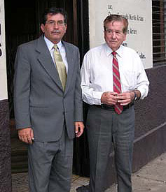
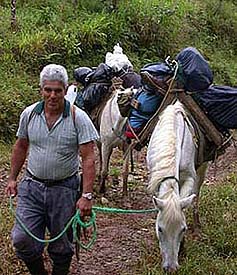
Dates and participants: A total of 43 people participated in the expeditions, from ten countries. Among the ALAS staff, Danilo Brenes and Ronald Vargas were present during all expeditions. Maylin Paniagua was present during the February and March expeditions. Flor Cascante attended the first week of the April expeditions. Ronald's wife Xinia Gomez was the cook, much to the delight and satisfaction of all participants.
The following expedition dates list visiting collaborators. Click on the dates for photo.
8-14 February:
Jack Longino, Anetta Szywilewska, Agnieszka Napierala, Mike Sharkey, Andy Boring, Kevin Pitz, Barb Sharanowski, Bill Haber, Piotr Naskrecki, Dave Wagner.
14-21 February:
Bob Anderson, Marc Epstein, Paul Goulet, Paul Johnson, Eduardo Lopez, Jens Prena.
8-14 March:
Don Davis, Mignon Davis, Jack Longino, Marc Pollet, Anja de Braekeleer, Jadranka Rota, Angel Solis.
14-21 March:
Michael Branstetter, John Brown, Daniel Clark, Shawn Clark, Laure Desutter, Jens Prena.
5-11 April:
G. B. Edwards, Frank González, Jiri Hulcr, Larry Kirkendall, Kenji Nishida, Armando Soto.
11-18 April:
Sibyl Bucheli, G. B. Edwards, Jose González, SangMi Lee, Daniel Santamaria, Daniel Solano.
Locality Data
The label we are using is:
COSTA RICA: Prov. Heredia:
9km NE Vara Blanca, 1450-
1550m, 10°14'N 84°06'W
_________________ 2005
INBio-OET-ALAS transect
The precise GPS coordinates for the Murillo House are 10°14.17'N 84°07.06'W. UTM 815775.87E, 1132950.20N (Zone 16, meters, Datum WGS84).
|
|
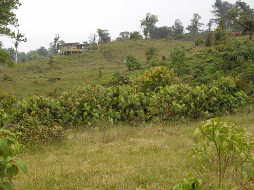
 The vicinity of the Murillo house is a mosaic of cleared pastures and mature forest. The pastures are on ridge tops and shallower slopes; the forest is in steep-sided ravines. The pastures are relatively small and are the edge of human clearing, with contiguous mature forest immediately to the south and east. The boundary of Braulio Carrillo National Park is about 2km to the east. The pastures are about 40 years old, dating from the first development of small farms in the zone. These farms proved unproductive over time and were gradually sold. The Murillo Finca is comprised of several of these old farms that were bought. There are scattered small farm houses from these old farms, but they are not currently inhabited by families or other long-term residents. Sr. Murillo maintains two field workers to manage the entire area. They keep the current pastures clear and maintain a low density of cattle on the property. The vicinity of the Murillo house is a mosaic of cleared pastures and mature forest. The pastures are on ridge tops and shallower slopes; the forest is in steep-sided ravines. The pastures are relatively small and are the edge of human clearing, with contiguous mature forest immediately to the south and east. The boundary of Braulio Carrillo National Park is about 2km to the east. The pastures are about 40 years old, dating from the first development of small farms in the zone. These farms proved unproductive over time and were gradually sold. The Murillo Finca is comprised of several of these old farms that were bought. There are scattered small farm houses from these old farms, but they are not currently inhabited by families or other long-term residents. Sr. Murillo maintains two field workers to manage the entire area. They keep the current pastures clear and maintain a low density of cattle on the property.
The pastures around the Murillo house are covered with low grasses and sedges. Rotting stumps and fallen logs from the original mature forest trees are abundant. These stumps and logs are covered with dense epiphyte mats, mostly small-leaved Ericaceae. The mature forest is tall evergreen forest with very heavy epiphyte loads, including abundant bryophyte mats.
Although there are no rainfall data for the site, it appears to be the wettest elevation on the Barva transect. It is undoubtedly similar to other mid-montane sites on the Atlantic slope that receive 7m or more rainfall per year. During January and February of 2005 it was extremely wet, with almost constant cold rain and mist, often accompanied by high winds. The soils were extremely waterlogged and soft, and it was difficult to walk anywhere in the pastures without sinking up to a meter deep in mud. The soils seemed to be a 1 meter thick layer of soft organic material over an impervious clay layer, so that water quickly accumulated on the surface. In contrast, March was clear, sunny, warm, and dry. The soils quickly dried and became firm. April was somewhat intermediate, with a combination of very wet weather and sunny periods.
|


